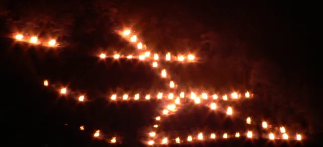
The August 16, 2026 Gozan Okuribi date has passed. The useful part of the 2026 plan is the geometry: five fires were scheduled to light in sequence from 20:00 to 20:20, each with different practical viewing corridors, while Kyoto City changed bus routes around Demachiyanagi, Kamigamo and Arashiyama from roughly 18:50 to 21:00. A future visit should therefore begin with one question: which fire can you see well without making the journey home unnecessarily difficult?
Do not copy the 2026 transport notices or assume the next edition will use identical crowd controls. The event is held annually on August 16, but operational details should be checked again for the actual year. The transferable rule is simpler: choose one primary fire, one exit corridor and one backup rather than trying to collect all five symbols in one night.
Gozan Okuribi in 30 seconds: choose by viewpoint and exit
↔ Scroll table left or right
Priority | 2026 reference area | Best fit | Main trade-off |
Daimonji as the first experience | Kamo River / Kyoto Imperial Palace side | First-time visitor staying in central or eastern Kyoto | Popular river approaches attract heavy pedestrian flow |
Myo / Ho | Kitayama and upper Takano River areas | Traveller already based north of the centre | Less useful if your hotel and next morning are around Kyoto Station |
Funagata | Kamo River around Kitayama Bridge to Nishigamo Bridge | Northern-Kyoto itinerary | You are committing farther from the central hotel grid |
Hidari Daimonji | Nishioji between Enmachi and Kinkakuji | Northwest-Kyoto day | It does not combine naturally with a Demachiyanagi exit plan |
Toriigata | Togetsukyo, Matsuo Bridge or Hirosawa Pond area | Traveller already spending the evening in Arashiyama | Longest commitment from central/eastern Kyoto |
The official 2026 viewing guide did not present one “best viewpoint.” It gave different viewing areas for each fire. That is the clue: this is not one skyline show with five equal objects. It is a citywide religious event whose visible result depends on where you already are.
The 20:00–20:20 sequence makes “see all five” a poor first-time target
The official 2026 lighting sequence was:
Daimonji: 20:00
Myo and Ho: 20:05
Funagata: 20:10
Hidari Daimonji: 20:15
Toriigata: 20:20
Each was expected to remain lit for roughly 30 minutes, with timing subject to weather. In theory that overlap tempts visitors to chase several symbols. In practice, streets, buildings, trees, crowd controls and the distance between viewing corridors make that a very different task from standing at one panoramic observation deck.
For a first visit, I would optimise for one clear symbol and a controlled exit. A second visible fire is a bonus. The failure mode is spending the most meaningful 20 minutes walking between obstructed sightlines because a map made the five mountains look closer together than the street experience feels.
Demachiyanagi works because Daimonji and the return route can share the same decision
Demachiyanagi is useful for Daimonji because the official guide identifies the Kamo River corridor as a viewing area and the Takano River upstream of Demachiyanagi for Ho. But the area is not magic: it is popular precisely because rail, river and viewing logic overlap.
In 2026, Kyoto City also changed some bus routes around Demachiyanagi during event traffic controls from roughly 18:50 to 21:00. The city added extra buses on several return corridors from around 20:00 to 21:00. That means an ordinary-day bus route was not a reliable event-night assumption.
ValueNavi rule: if Demachiyanagi is the viewpoint, decide before 19:00 whether the return is Keihan, another rail/subway connection, walking to the hotel or an event-day bus route you have checked. Do not reach the finale and then ask a normal map app to invent the easiest path through temporary controls.
If the hotel base itself is undecided, compare Kyoto Station vs Gion and where to stay for Kyoto summer events. One specialist night rarely justifies making the other Kyoto days worse.
The official crowd livestream is a better model than a “secret spot” post
For 2026, Kyoto's official tourism site installed a livestream near Kamo Ohashi Bridge from around 18:00 to 21:00 so visitors could check congestion in real time. That is unusually useful because crowd density is a same-evening variable.
A future equivalent tool, if offered, should outrank a saved social-media pin. A viewpoint can be legal and visually good yet still become the wrong option when the approach is saturated. Use live crowd information to decide whether to continue toward the river or use the backup you chose earlier.
Riverbank access is not guaranteed viewing space
Official safety guidance warns that riverbanks can be closed when water levels are high. It also advises visitors to avoid riverbanks at night even when water levels are normal because the ground is dark and there is a fall risk.
That changes the backup plan. “If the main riverbank is crowded, I will just move lower onto the bank” is not a robust strategy. Choose a second legal street-level or park-side area before the evening, and follow staff instructions if access changes.
If rain affects more than the event, use the Japan rainy-day itinerary backup guide rather than protecting a sunk-cost outdoor plan.
Do not climb the Okuribi mountains on August 16
Kyoto's official guidance prohibits entering the hills where the fires are held on the event day for safety and to avoid interfering with the ceremony. The trails are not lit. Some of the mountains are closed more broadly outside the event as well.
This is an important boundary condition because “get closer” is the wrong instinct. The event is designed to be viewed from the city. A hiking route is not a clever alternative viewpoint.
The best daytime plan ends near the evening viewing corridor
Gozan Okuribi becomes inefficient when the daytime itinerary finishes on the opposite side of Kyoto. A Kibune or northern-Kyoto day can pair naturally with a northern viewing plan if you protect a large transport buffer. An Arashiyama day can support Toriigata more naturally than travelling back east for Daimonji and then returning west again.
↔ Scroll table left or right
Daytime area | Evening logic | What to avoid |
Gion / central east | Daimonji / Demachiyanagi corridor is the easiest first comparison | Cross-city detour to Arashiyama purely for Toriigata |
Kibune / north | Keep a northern fire/viewpoint in play | Assuming ordinary bus timing survives event traffic |
Kinkakuji / northwest | Hidari Daimonji can fit the geography | Returning to Demachiyanagi solely because it is famous online |
Arashiyama | Toriigata can make the whole day directional | Trying to see Daimonji first and then race west |
If the day includes Kibune kawadoko and Kifune Shrine, treat the mountain-to-city transport as a hard dependency rather than an optional buffer.
Photography should not create a second crowd problem
A large tripod can be awkward in narrow pedestrian areas, and the event's short lighting window makes constant repositioning a poor use of time. Arrive with the primary composition already chosen, keep screens dim, avoid flash and step out of the pedestrian flow before reviewing images.
The strongest photography plan may be one frame done well rather than a checklist of five distant symbols. This is a religious observance first, not a citywide scavenger hunt.
Should you stay in Kyoto that night or return to Osaka?
A same-night Osaka return can be perfectly workable when the hotel is already there and you have a simple rail route from the chosen viewpoint. It is weaker when the plan requires crossing Kyoto after 20:30 to reach a specific departure station.
One Kyoto night earns its cost when it removes that fragile cross-city chain and improves the next morning too. It does not earn its cost merely because Gozan Okuribi is famous. Use Kyoto vs Osaka to decide the base from the full Kansai itinerary, not one evening.
Final verdict
Use the 2026 Gozan Okuribi plan as a viewpoint-and-exit blueprint, not as a future timetable. The five fires were scheduled in a 20-minute sequence, but each had a different practical viewing corridor and event-night transport controls changed normal bus assumptions. For most first-time visitors, one clear fire—usually Daimonji when the hotel and daytime route already favour central/eastern Kyoto—plus one known exit and one backup is a better night than attempting to chase all five.
For the next edition, recheck the official lighting information, river safety notice, live crowd tools and Kyoto City transport changes before setting the exact viewing point.
References
Kyoto City Official Travel Guide — 2026 Gozan Okuribi safety and crowd-livestream information
Kyoto City Official Travel Guide — 2026 lighting sequence and recommended viewing corridors
Kyoto City Transportation Bureau — 2026 temporary bus-route changes
Kyoto City Transportation Bureau — 2026 extra return buses and subway guidance